Read all posts from this expedition to South Korea
It is difficult to convey size with the written word.
On the west coast of the Korean peninsula, the Saemangeum (say-MAHN-gum) reclamation project hosts the longest seawall in the world. But that is an architectural reference that means little to those outside coastal Louisiana, or the Netherlands.
Saemangeum is visible from space. But, courtesy of Google Earth, this hyperbolic expression can now include the car in your driveway.
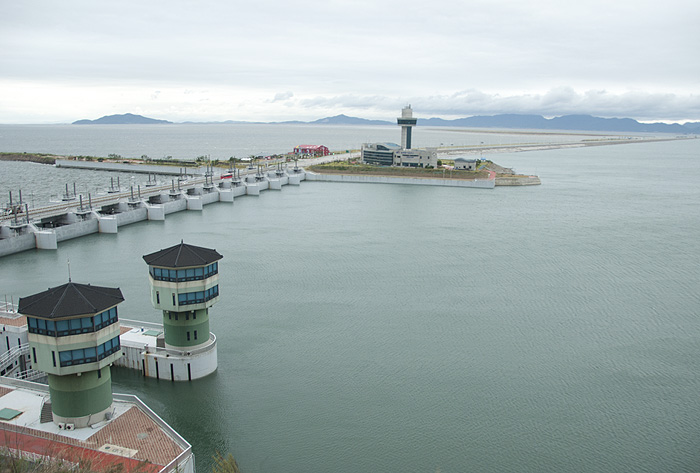
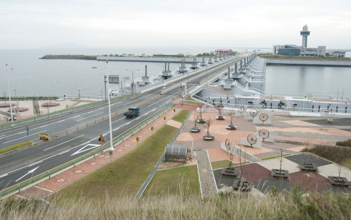
The seawall is wide enough to accommodate five lanes of traffic, an equal width of cement blocks for shoreline armament, and several sparsely planted parks and vantage points from which people can attempt to see both ends of this feat of engineering.
Oh, and it’s 21 miles long. That’s twelve times the length of Golden Gate Bridge and 50% longer than Manhattan Island.

The Saemangeum seawall is the beginning of the largest tidal reclamation project in South Korea, a country where over three quarters of the tidal flats have been covered in dirt and capped with cement and small cities. The shimmering Incheon airport outside of Seoul is perched on reclaimed soil between two existing islands. A massive cable-stayed bridge – the seventh longest in the world when it was built in 2010 – connects the airport with the mainland. Visitors to South Korea are greeted by a plump sprout of skyscrapers at the mainland base of the bridge—an area, our Korean hosts pointed out, that was healthy tidal flats only five years prior.
The nationwide reclamation effort supports a massive construction industry and tens of thousands of jobs. It expands agricultural lands and relieves pressure of a growing population on a peninsula that is bulging at the seams.
But, ecologically, mud is more valuable than cement. The myriad of invertebrates – from worms to clams and crabs – disappear, as well as the birds and fish that depend on this irreplaceable food source. Water quality plummets as the natural filtration of brackish wetlands is replaced with more sources for urban runoff.
A cornucopia of important birds that depend on estuaries like this in the Yellow Sea, including vulnerable Relict Gulls, endangered Black-faced Spoonbills and Nordmann’s Greenshanks, and critically-endangered Spoon-billed Sandpipers.
The seawall at Saemangeum is the first of a multi-stage, $18 billion dollar effort to create a new economic zone on coastal Korea—the “Dubai of Asia.” Once closed, the sluice gates of the seawall cut off natural tidal action, drying the once-rich mud. Further inland, grasses are planted to remove additional moisture and harden the soil. Earthmovers and dump trucks build a series of rectangular dikes along the rim of the enclosed lake, gradually draining the water and infilling with soil. Streets, parks, stores, and residential high rises will follow to fuel an industrial complex unrivaled in northeast Asia. Once complete, the whole development will be 155 square miles—nearly five times the size of Manhattan Island.
The seawall, completed in 2010, stretches out in an arch across the bay, sweeping up two small islands before it connects on the other side, severing from the ocean 115 square miles of tidal flats and an estuary fed by two rivers.
Dr. Nials Moore of Birds Korea led a regular shorebird census within Saemangeum to capture the impact of the construction on migrating shorebirds. Soon after the sluice gates closed for the first time, his Korean volunteers asked about the next high tide, a normal inquiry for those who track birds that rely on these tidally influenced ecosystems.
“There will never be a high tide here again,” Dr. Moore solemnly stated—a fact he’d have to repeat several times that day. “It took a while to sink in.”
We visited the seawall on a day that didn’t bode well for bird photography: the weaker perimeter of a long-awaited typhoon made landfall that morning. Howling winds churned the saltwater on one side of the seawall, dashing any hopes of a rare sighting of the native finless porpoises pictured on the interpretive signage along the road. The inland side offered a placid expanse of water, growing less and less saline as the rivers continue to empty into the contained space. The sluice gates regularly open to relieve the building pressure.
At the southern base of the seawall lie the polished marble floors of the Saemangeum Information Center. The vaulted ceilings and expansive windows offer tourists a view of the entire project. Interactive displays assert the economic prosperity it will bring to the region.
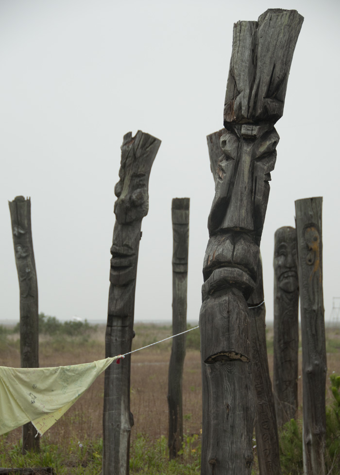
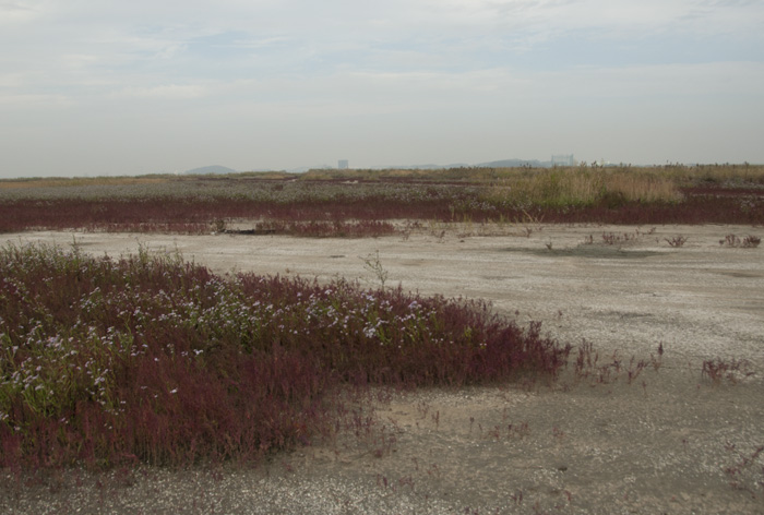
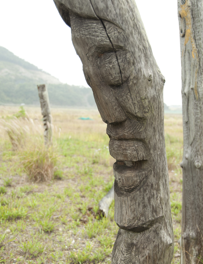
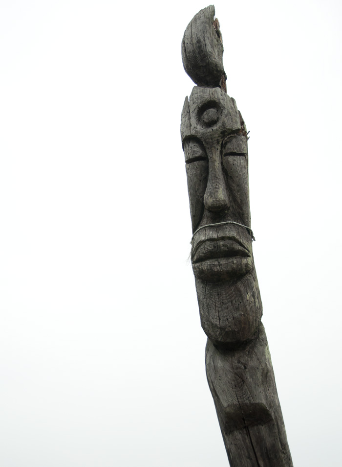
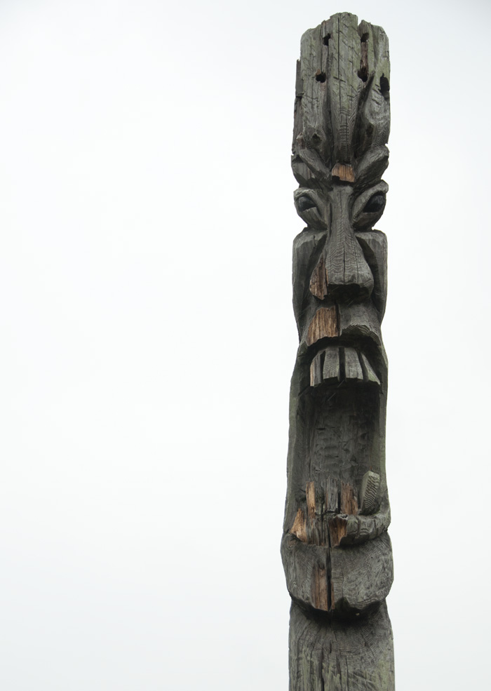
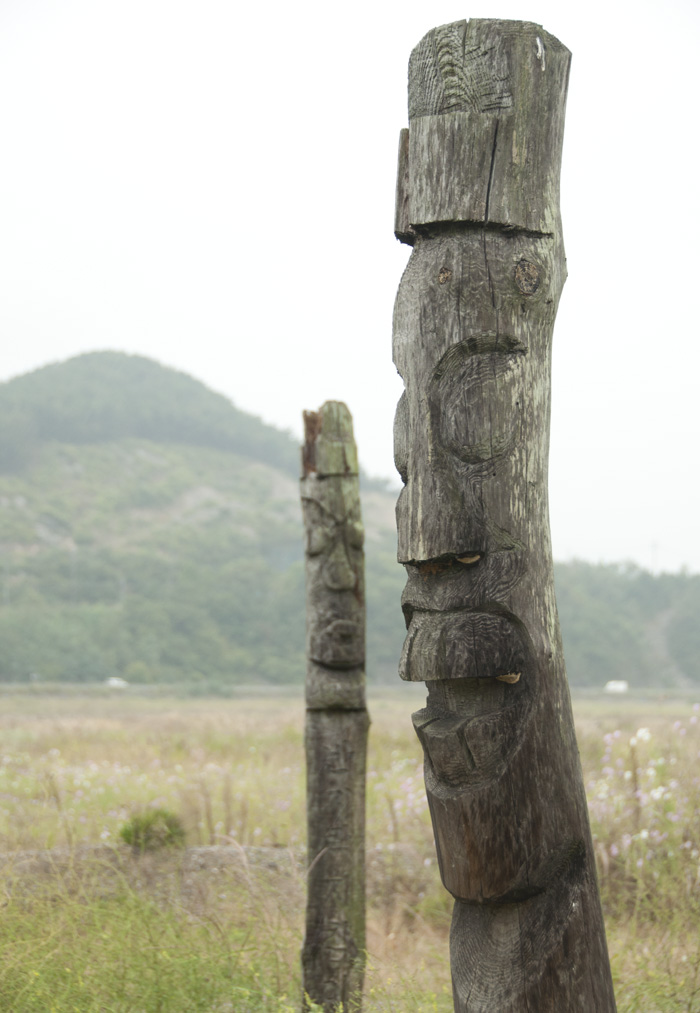
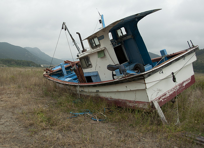
But one needn’t travel far for a reminder that this project wasn’t without controversy. A few minutes down the road from the Information Center, you can find a disparate stand of wood poles, grayed by time, perched in a field. We parked on the shoulder and walk down to the grassy expanse, itself a former tide flat. Every pole was a different height and thickness but each revealed a frightful face, contorted with emotion. Jangseung totems are traditionally placed at the perimeter of Korean villages to ward away evil; locals had used them to protest the project, with banners that read “S.O.S.”—Save Our Saemangeum. Down a small gravel road rested a fishing boat, deserted by a receding tide that never returned.
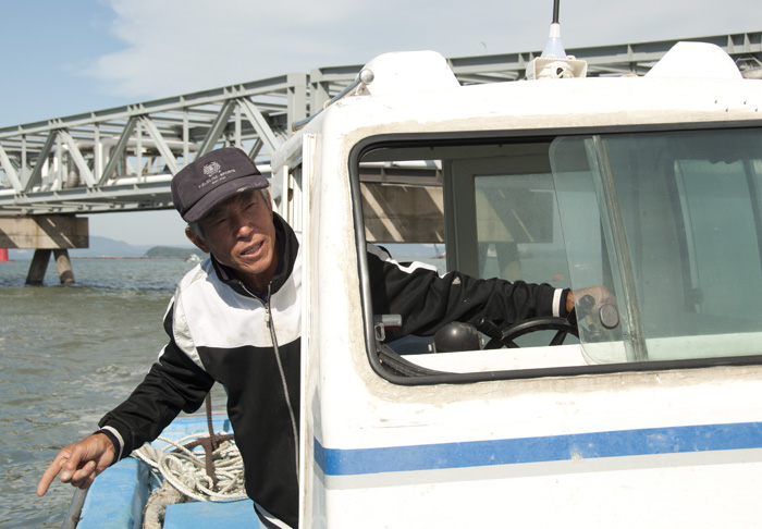
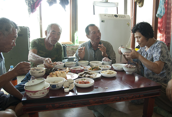
The seawall also expelled local fishermen from formerly rich waters for fish and fertile mudflats for crabs and clams. This impacted those close to this expedition. Our source of transportation to nearby Yubu Island was a fisherman who had to supplement his income by ferrying bird photographers to one of the last remaining mudflats in the area that hosted migrating Spoon-billed Sandpipers. Over a generous lunch of clam soup and kimchi crabs, we heard him and his fellow fishermen lament about how they had to travel further to find less—a formula that is squeezing their livelihood dry.
The following morning—under the cover of darkness—we drove one of the dikes that rimmed the reclamation area. Dr. Moore had seen several “spoonies” there the previous afternoon and, even though the area was technically off limits, the opportunity to photograph a critically endangered Spoon-billed Sandpiper in the area that may hasten its demise was too tempting to the team.
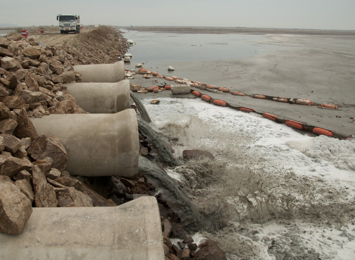
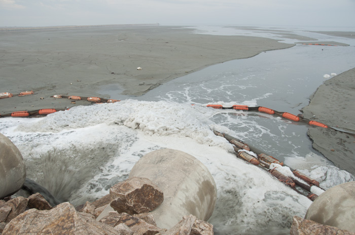
We unloaded our gear behind a wall, about a kilometer away from the main road. Beneath us, several large pipes spewed water from the field of mud on the other side of the dyke. Gerrit and I walked cautiously out along side the ephemeral stream—towards the open water—where the sandy effluvium was (barely) firm enough to support our weight. A path had to be chosen carefully; a careless step would find you up to your shin, or even your knee, in Jello-like mud that was reluctant to let you go.
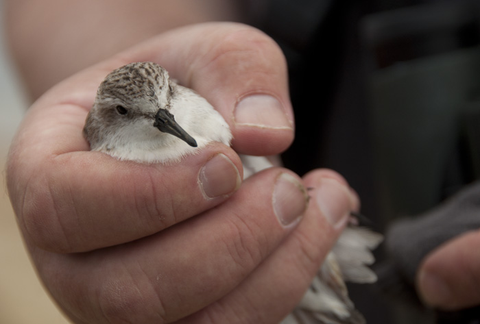
We found three dead shorebirds along the edge of this flow in the same area where the Spoon-billed Sandpipers had been spotted. Fortunately, they were all Red-necked Stints, one of the more numerous of the migratory shorebirds. Gerrit moved further out in the mud to film the dead bird with an ominous backdrop: a crane building the next dike using earth transported by a long string of dump trucks.
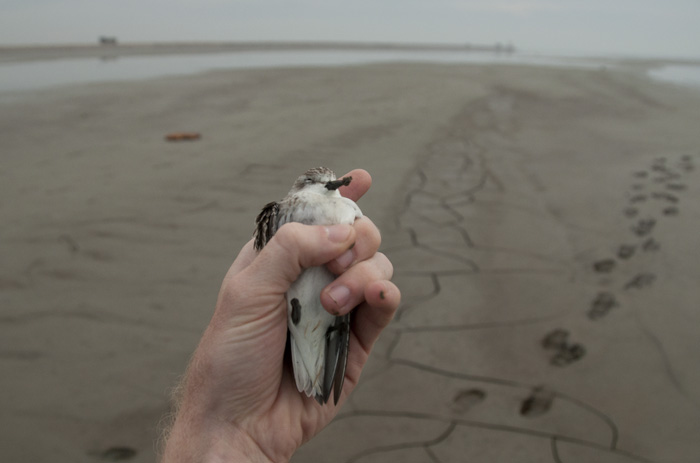
The placement of stints’ bodies next to the foamy runoff was concerning. Dr. Moores surreptitiously sent them to a lab for testing. A live, though severely incapacitated, Red-necked Stint was found and sent to a wildlife rehabilitator. Once news of our presence in the active construction zone reached the central office, we were escorted – courteously – off the premises.
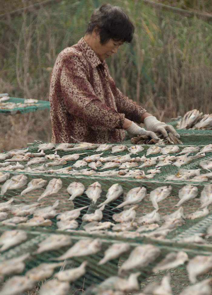
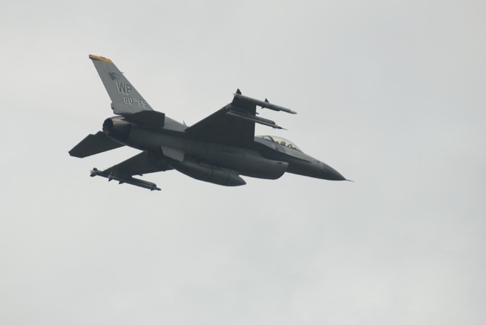
The following morning, on our way back to Seoul, we visited a far-flung corner of the Saemangeum. We were looking for a stand of pillars, encrusted with barnacles, in fields of grass that were now miles from water. Unfortunately, the pillars couldn’t be located, but we met a small group of people drying fish on long, rectangular nets. The subtle hum of the flies that swarmed the pungent fish was no match for the acoustic impact of the nearby American military base. Five fighter jets, within thirty seconds of one another, buzzed the ground only hundreds of feet above our heads. These were the same fighter jets that had interrupted many of my audio recordings from Yubu Island, located further down the planes’ paths. We had to cup our ears to protect against the earsplitting roar; the weathered faces of these elders hardly flinched as they continued their daily routine.
As we drove away, the ringing in my ears resonated like the plight of the Saemangeum in my consciousness. The ecosystem here has been irreversibly altered, but there’s hope. South Korea is one of the most connected countries in the world; there are more wireless connections in the country than there are people. If a compelling reason for action is created, and the message resonates, it can reach a lot of people.
And if humans can leverage technology and sheer will to literally move mountains to build a sea wall, they are certainly capable of saving a bird that weighs as much as a pebble.


Resources:
- “South Korea builds city from sea at wetland’s expense.” Reuters. November 23, 2008.
- “The Ministry of Agriculture and Forestry’s Defence of the Saemangeum Reclamation: Credible Science or Wishful Thinking?” Birds Korea blog. September 2003
- “Environmentalists decry Korean sea wall.” Christian Science Monitor. March 21, 2006.
- “New Songdo City and the Value of Flexibility: A Case Study of Implementation and Analysis of a Mega-Scale Project.” Massachusetts Institute of Technology. September 2008.
- “Big question on Saemangeum: Will foreign investors come?” Korea Times. May 14, 2010.
